From Villar-Loubière to La-Chapelle-en-Valgaudemar
The climb to the Souffles mountain refuge is made by a footpath worthy of an alpine garden with its flowers and butterflies. If you are lucky, you will hear the black grouse before you arrive at the refuge, where you will be able to watch vultures flying above the Lautier lake. In any case, you have every chance of seeing a chamois on your way to the Colombe pass.
15 points of interest
 Geology and geography
Arraches
From the refuge, or during the climb, a peculiar geological formation may catch your eye on the opposite bank, above the old hamlet of Peines. Sedimentary rocks are trapped in the middle of crystalline formations where erosion has created a specific pattern of erosion that looks like a giant tiger has clawed at the rock. This morphology is what gave it the name Arraches. Pastoralism
Sheep on the mountain pasture
During your walk, you might come across sheep on the mountain pastures. This is an old form of pastoralism, as proven by the dry stone enclosures that you will see. These are known as 'jas'. You will also notice a rock shelter near to the Clot. The sheep that are in these pastures belong to breeders from the valley or from the Bas Champsaur area. Fauna
FaunaBlack Grouse
The upper limit of the forest is where you are likely to see the black grouse. The female has faith in her bland-coloured feathering that camouflages her in the vegetation, making her difficult to spot. On the other hand, the male, which is black and white with red "eyebrows”, is not so private, particularly during the reproduction season when their cooing and hissing sounds echo in the mountain in the early morning. Flora
FloraVariety of the natural environment
This walk is a summary of south facing slopes in the Valgaudemar area. It starts in the warm scree that it more or less vegetated. It then progresses over lawns and moors of juniper, blueberries or bearberries... They give way to mountain ash, whitebeam and amelanchiers indicating that the forest will soon take over. Higher up, the beech forest casts shade on the walkers, next a beautiful larch forest is a sign that the forest environment will give way to the high altitude moors and lawns. The Lautier lake and the surrounding ponds are a haven for aquatic species. Still higher, is the realm of rocks and chamois.- Flora
Variety of plant life
There is a large variety of plant life along the itinerary, particularly on the slopes above the refuge, due to the exposure, the soil types and the altitude. Marjoram, lis, laserwort, houseleek, stinecrop, gentian, columbine, aconite and many others are present.  Hut
HutSouffles mountain refuge
The Souffles mountain refuge is managed by the CAF (French Alpine Club). A keeper is present from June to September. Here you have the opportunity to get something to eat whilst chatting with a mountain professional or spend a night at high altitude if you prefer. This is a good way to split the itinerary in two. Panorama
Remarkable views
The view over the valley as seen from the Souffles refuge is well worth the trip. Along the crossing from the Clochettes pass to the Colombe pass, there are numerous viewpoints that give multiple variations on a single theme: that of a high mountain valley. Lake
LakeLautier Lake
This is a remarkable site. Brown trout are reared here for the delight of anglers.- Fauna
Alpine newt and ponds
At high altitude, it is possible to see two amphibian species. These are the common frog and the alpine newt. The latter is rarer. It is a fragile species and consequently a protected one. When adult, it resembles a small lizard. In its aquatic cycle, the male has an orange colour on its belly and throat. Most of the time when we watch it in the lake, it is motionless with its feet spread out, as though it were weightless. If it is frightened, a swift movement of the tail and it will find refuge under a stone. The lake is used for rearing which is not a good thing for newts that are food to fish. On the other hand, the ponds that are situated above the lake do not have fish and the alpine newts are at home and reproduce there. - Fauna
Rock partridge
The rock partridge likes rocks and open moors where the young can feed on the insects that are necessary for their growth. It is not rare to see a group towards the Lautier lake or the Colombe pass. - Fauna
Large birds of prey
The golden eagle can be seen all year round in the area that they have chosen for their home. In the summer, it is not rare to see griffon vultures gliding above the pastures in search of corpses. On the other hand, it is rare to spot the bearded vulture. This vulture that lives on bones is being reintroduced to the Alps. The Vercors is the nearest place where they are being released. - Fauna
Chamois
A silhouette that stands out on a ridge, a worried whistling sound or bustling in the shingle...there are numerous opportunities to see this animal that is emblematic of the mountain. - Geology and geography
Bourelle Gorge
Since the end of the ice age, water has carved the rock and the passage of materials has created a small gorge polishing the base rock (gneiss, micaschists). The National Park has taken on the challenge of building a wooden walkway for walkers to cross this gorge.
- Flora
Heather fields
Over a change in altitude of a hundred metres there is a covering of heather which provides pollen for the bees and purple colour in Autumn, A small persistent shrub with tiny leaves and little pink flowers, it is called Common Heather or False Heather.
 Water
WaterCombefroide Waterfall
At the beginning of the path, is a big waterfall that you can approach on a narrow footpath just before climbing the coast. Situated on Combefroide torrent at a rocky escarpment, this waterfall has several projections and presents a total drop of several dozen metres.
Description
From the Villard Loubière car park, head up to the village by following the signs for Souffles mountain refuge on the GR54. The footpath progresses through the shingle and moors and into a narrow valley. As you get closer to the refuge, beech trees appear, then larch trees line the way up to the Souffles mountain refuge that is at an altitude of 1968 m. Leave the GR route and take the footpath behind the refuge towards the Lautier lake. Crossing the Clochettes pass will lead you to the Lautier valley. Do not take the path that goes down into the valley but continue towards the lake, which will soon be visible. Then head to the nearby Colombes pass, which is at an altitude of 2427 m (from where it is possible head off up to the Turbat Peak, 3028 m, by an off-trail itinerary). Start the long descent towards La Chapelle en Valgaudemar. Leave the path on the left that goes to the Pas de l'Olan and the refuge of the same name, and continue the descent via Le Clot until you reach La Chapelle en Valgaudemar at an altitude of 1100 m.
- Departure : Villar Loubière car park
- Arrival : Olan mountain refuge car park, La Chapelle-en-Valgaudemar
- Towns crossed : Villar-Loubière and La Chapelle-en-Valgaudemar
Forecast
Altimetric profile
Recommandations
If you are driving, you will need to organise a shuttle, leaving a vehicle at the starting point, which is the Olan refuge car park just after the village of La Chapelle en Valgaudemar. You can also use the Conseil Général's shuttle service. For information call 04 92 502 505.

Information desks
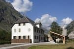
Valgaudemar Park house
Ancien Asile Saint-Paul, 05800 La Chapelle-en-Valgaudemar
Information, documentation and a reception area with permanent and temporary exhibitions. La Maison du Parc is labeled "Tourism and Disability". Free admission. All animations of the Park are free unless otherwise stated.
Transport
Conseil Général shuttle from St Firmin. Connection with buses coming from Gap or Grenoble.
Access and parking
From the N85 take the D985 that goes to the Valegaudemar valley up to Villard Loubière.
Parking :
Source

Report a problem or an error
If you have found an error on this page or if you have noticed any problems during your hike, please report them to us here: