Valgaudemar refuges
The route runs below such legendary summits as the Olan, Les Rouies, Les Bancs and the Sirac. The stone and glacier atmosphere is replaced by bucolic Alpine pastures with breathtaking views. Wild fauna and Alpine flora can be seen all along the way. And encounters are not rare between mountain-climbers, enthusiastic hikers and lovers of wide-open spaces, who travel along the trails as soon as the fine weather returns.
Tommy Bulle, Valgaudemar park keeper
7 steps
51 points of interest
 History
Villar-Loubière windmill
As you begin the steep climb towards the Col de la Vaurze, don’t miss the unusual Villar windmill, covered in vegetation. Built in 1838, this legacy from past times has been perfectly preserved with its curious horizontal wheel. It was still in use 50 years ago, milling wheat, but also nuts and rapeseed. It was restored in 1979 and is the last working windmill in the Valgaudemar valley.
 Geology and geography
Arraches
From the refuge, or during the climb, a peculiar geological formation may catch your eye on the opposite bank, above the old hamlet of Peines. Sedimentary rocks are trapped in the middle of crystalline formations where erosion has created a specific pattern of erosion that looks like a giant tiger has clawed at the rock. This morphology is what gave it the name Arraches. Pastoralism
Sheep on the mountain pasture
During your walk, you might come across sheep on the mountain pastures. This is an old form of pastoralism, as proven by the dry stone enclosures that you will see. These are known as 'jas'. You will also notice a rock shelter near to the Clot. The sheep that are in these pastures belong to breeders from the valley or from the Bas Champsaur area. Fauna
FaunaBlack Grouse
The upper limit of the forest is where you are likely to see the black grouse. The female has faith in her bland-coloured feathering that camouflages her in the vegetation, making her difficult to spot. On the other hand, the male, which is black and white with red "eyebrows”, is not so private, particularly during the reproduction season when their cooing and hissing sounds echo in the mountain in the early morning. Flora
FloraVariety of the natural environment
This walk is a summary of south facing slopes in the Valgaudemar area. It starts in the warm scree that it more or less vegetated. It then progresses over lawns and moors of juniper, blueberries or bearberries... They give way to mountain ash, whitebeam and amelanchiers indicating that the forest will soon take over. Higher up, the beech forest casts shade on the walkers, next a beautiful larch forest is a sign that the forest environment will give way to the high altitude moors and lawns. The Lautier lake and the surrounding ponds are a haven for aquatic species. Still higher, is the realm of rocks and chamois.- Flora
Variety of plant life
There is a large variety of plant life along the itinerary, particularly on the slopes above the refuge, due to the exposure, the soil types and the altitude. Marjoram, lis, laserwort, houseleek, stinecrop, gentian, columbine, aconite and many others are present.  Hut
HutSouffles mountain refuge
The Souffles mountain refuge is managed by the CAF (French Alpine Club). A keeper is present from June to September. Here you have the opportunity to get something to eat whilst chatting with a mountain professional or spend a night at high altitude if you prefer. This is a good way to split the itinerary in two. Panorama
Remarkable views
The view over the valley as seen from the Souffles refuge is well worth the trip. Along the crossing from the Clochettes pass to the Colombe pass, there are numerous viewpoints that give multiple variations on a single theme: that of a high mountain valley. Lake
LakeLautier Lake
This is a remarkable site. Brown trout are reared here for the delight of anglers.- Fauna
Alpine newt and ponds
At high altitude, it is possible to see two amphibian species. These are the common frog and the alpine newt. The latter is rarer. It is a fragile species and consequently a protected one. When adult, it resembles a small lizard. In its aquatic cycle, the male has an orange colour on its belly and throat. Most of the time when we watch it in the lake, it is motionless with its feet spread out, as though it were weightless. If it is frightened, a swift movement of the tail and it will find refuge under a stone. The lake is used for rearing which is not a good thing for newts that are food to fish. On the other hand, the ponds that are situated above the lake do not have fish and the alpine newts are at home and reproduce there. - Fauna
Rock partridge
The rock partridge likes rocks and open moors where the young can feed on the insects that are necessary for their growth. It is not rare to see a group towards the Lautier lake or the Colombe pass. - Flora
Flora at altitude
With a large altitudinal range, the variety of environments and the strong Southern exposure, floral diversity is extremely rich and varied. Most notably you can see the Tiger Lily, which stands out in its environment by the striking originality of its colour and the yellow gentian whose roots are used to make a bitter “eau de vie” with many virtues.
 Top
TopThe Olan « summits »
L'Olan is a major summit in the Écrins massif. Il culminates at 3564 m and is composed of three summits of which the highest is the Northern summit. The Olan was climbed for the first time right to the central summit on the 8th July 1875, then the Northern summit on the 29th June 1877 by the famous W.B.A Coolidge and his guide Almer. A normal route setting out from the Olan refuge can, with a guide or the right mountaineering knowledge, be the goal of an ascent in the Valgaudemar.
- History
Ancient refuge at Pas de l'Olan
When you arrive at Pas de l'Olan, there are a few traces of the first refuge which was under the rocky mountain wall. Looking more like a large log cabin, it was unfortunately squashed by a rock. Due to its remoteness from the valley, the men chose to rebuild it on the current site.
- Fauna
Chamois, Ibex, ...
All along the path, fauna is present. Watch out for the eagle and the vultures that glide on the ascending winds, as well as the chamois who spy on the world below. A few Ibex can sometimes be observed by mountaineers on the slopes of the Olan, without forgetting the marmot who punctuates the ascent with its strident cry.
- Panorama
View of La Chapelle and the surrounding mountains
The roof of Olan refuge makes a remarkable belvedere over La Chapelle village and the surrounding mountains which are the imposing Olan, the Cime du Vallon and the Rouye. A little higher up, the Pas de l'Olan provides a point of view of the entrance to the Valgaudemar valley and of the other face of the Olan.
- Hut
Olan Refuge
Situated at an altitude of 2350 m, this large building constructed in 1957 was carried away by an avalanche two years later. A witness to this is a concrete slab below the refuge. Rebuilt in 1966, it was definitively extended in 1978 with a capacity of 54 places. A stage of the Tour de l'Oisans (GR 54), it welcomes hikers in the summer season and provides a shelter in the winter; it belongs to the Club Alpin Français.
 Vernacular heritage
Jas crossing of the Bourelle
Just above the signpost, there are the ruins of a pasture shelter commonly called the, « jas ». Often built using dry stones, this kind of shelter was used to protect the flocks during the summer season.
- Geology and geography
Bourelle Gorge
Since the end of the ice age, water has carved the rock and the passage of materials has created a small gorge polishing the base rock (gneiss, micaschists). The National Park has taken on the challenge of building a wooden walkway for walkers to cross this gorge.
- Flora
Heather fields
Over a change in altitude of a hundred metres there is a covering of heather which provides pollen for the bees and purple colour in Autumn, A small persistent shrub with tiny leaves and little pink flowers, it is called Common Heather or False Heather.
 Water
WaterCombefroide Waterfall
At the beginning of the path, is a big waterfall that you can approach on a narrow footpath just before climbing the coast. Situated on Combefroide torrent at a rocky escarpment, this waterfall has several projections and presents a total drop of several dozen metres.
- Flora
Hayfields
Hayfields surround the village of La Chapelle. Unfortunately, such natural hayfields, and their flowers and insects, are more and more frequently replaced by temporary hayfields, in other words, certain years they are sowed. These prairies are still watered by the irrigation canals that are well maintained by the users with the help of the National Park. You will see the floodway of the Grande Levée canal not far from the stream as it nears the Sèveraisse. The canals are of great importance for preserving wetland flora, such as alternate-leaved golden saxifrage or yellow star-of-Bethlehem, both of which are protected species.
- Panorama
Waterfalls and view points over the valley
Along the itinerary, you will see the Combefroide and Casset waterfalls that are situated on the south facing slopes of the valley. The route also gives a good view to the east and the west of the Sèveraisse valley from the hamlet of Casset. Downstream, from the hamlet of Rif du Sap, a good example of a U-shaped valley is proof of shaping by the quaternary glaciers. - History
An itinerary packed with history
The Casset bridge is the oldest remaining bridge over the Sèveraisse that has not been washed away by floods. On the right bank of this magnificent "Roman" structure, the hamlet of Casset gets its name from the "casse" (large steep scree deposits at the foot of slopes) that surround it. This village, like that of Le Bourg, was partly covered by a landslide. As for Le Rif du Sap, an avalanche swept away the houses from the top of the hamlet in 1944. The hamlet of Le Clot, was flooded in 1928, and was totally abandoned in 1934 when a fire destroyed most of the dwellings. - History
Toponymy in the Valgaudemar area
Valgaudemar! The sound of this name resonates in our ears. Some claim that it is in reference to the valley of Mary "Gaude Marie" or "Rejoice Mary!" It is more reasonable to think that it is in reference to Gaudemar, the last king of the Burgundians (524) a Germanic tribe that invaded this area in 406...Vallis Gaudemarii can be read in texts as early as 1284. Poetic licence, legends and imagination are often red herrings when it comes to researching the origins of names.  Architecture
Traditional dwellings
A few typical, old Valgaudemar houses can be seen in the hamlets of Casse, Le Bourg and Le Rif du Sap. A few thatched roofs, vaulted entrances to dwellings ("tounes"), and stone paving, are some fine examples of architecture that are worth saving. Cheaper and requiring less maintenance, sheet metal gradually replaced the thatch on the rooftops.- Fauna
Golden eagle
Between La Chapelle and Le Clot, it is not rare to see the golden eagle flying over the sunlit slopes. In the summer, this majestic bird of prey with its dark plumage (some have lovely white rosettes on the underside of their wings) mingles with the short-toed eagle, which is smaller and lighter-coloured, and the griffon vulture, which is larger, with a short tail and often flies in groups. There is nothing surprising about this as the south facing slopes provides thermal lift that enables them to fly high and far.
- Architecture
"Toune"
This is an architectural feature of the Champsaur-Valgaudemar area and is the barrel-vaulted porch on the main facade of the house. It sheltered the entrance to the dwelling and stable and was sometimes used to stock items, such as wood, to keep it dry. The "toune" was often painted white to reflect the sunlight. They inhabitants would sit in them to do embroidery or darning, etc. - Vernacular heritage
Walled paths
On certain stretches of the route, you will walk between two stone walls. Such "via clause" were built to stop the domestic animals, on their way up to the pastures, from walking on or eating the grass in the prairies that was intended for them in the winter. The most remarkable "via clause" is on the way out of the hamlet of Le Clot. It has been restored by the Ecrins National Park.
. - Hut
Clot Xavier Blanc mountain refuge
What a strange idea to build this mountain refuge below the road leading to Gioberney, at an altitude of "only" 1397 m. In fact, it was already there more than a century ago, long before the road was built. This simple, sturdy building belonged to the Valgodemar Mining Company that operated in the area extracting copper and lead. When the business closed, the Club Alpin Français bought the building and named it after Xavier Blanc, in recognition of one of the founder members of the CAF, senator of the Hautes Alpes. - History
The Minister's footpath
A strange name for a footpath... Two explanations are given. The first, simply suggests that a minister inaugurated, or at least used, the footpath. The second, which is more likely, explains that donkeys were also known as ministers. Indeed, these animals were priceless to peasants of the time and they were pampered and treated accordingly. This path, which is mostly flat would have been well suited for them, and it would seem logical that it was given this name. - Hut
Châlet-hôtel in Gioberney
The construction of the chalet-hôtel at Gioberney started during the Second World War as part of a youth project. It enabled some young people the possibility of escaping obligatory work service in Germany (STO). The stones for the building were taken on the spot, cut and put together using cement mortar. At that time the road to Gioberney did not yet exist, and would only be built in 1963. You had to go up on foot, for « tired intellectuals », it was possible to be helped by a mule in order to reach the refuge. There was not much frequentation until the construction of the road...
- Fauna
Northern Bat
The Northern Bat is a boreal bat, a glacial relict in the Alpine arc. Adapted to the cold, it resists temperatures close to -7°C for short periods of time. The Northern Bat is a discreet species that lives in boreal forests scattered with humid areas. It sometimes hunts near to public lighting, one of the only places where it is easy to observe it. The capture of females at this site has enabled us to believe in the presence of a colony at Gioberney. It would be the first known reproducing colonies in France.
- Flora
The different environments
From an altitude of between 1600 m to 2450 m, this itinerary invites you to cross different kinds of environment. Blueberry bushes and rhododendrons on the minerals of the scree slope, the green larch pastures, and this trip will be punctuated by different environments with their specific flora and fauna.
- Fauna
Common frog
Sometimes in the water, sometimes out of it, this is the amphibian of the summits. With the Alpine Newt, it occupies the smallest puddle of water up to the most impressive altitudes. (2800 m). In a state of lethargy during more than 8 months of the year due to the bitter winter it is a symbol of adaptability to altitude. In the winter it burrows into the mud or slides out of the water under leaves, a tree stump or a rock to shelter from the frost.. It lays up to 4000 eggs on average, since it is confronted with climatic conditions and predators (newts, fish...), only a few individuals will reach adulthood in order to ensure the sustainability of the population. A real example of adaptability at altitude !
 Glacier
The glaciers
Gioberney glacial cirque offers a 180° panorama of the magnificent Rouies glaciers, the Condamine at the foot of the Bans... Today, in retreat, (the polished glaciers remain as slabs smoothed by the erosive action of these ‘ice monsters’) a witness to their past.
- Top
The summits
At the bottom of Valgaudemar, this loop enables you to fully appreciate « Himalayas of the Alps ». This cirque du Gioberney is topped with superb summits easily more than 3000 m altitude. From the west to the east, The Rouies and their 3589 m, the Pic du Says (3420 m), the Mont Gioberney (3352 m),the Pointe Richardson (3312 m), the famous Bans (3505 m) and the Aupillous at 3458 m. With three glacial cirques which blend in to one and its high summits, one really touches the domain of mountaineering here.
- Fauna
The Common Hawker or Sedge Darner
Beside the small pond at the Pigeon Loft refuge, you could have the surprise of seeing this big dragon fly, the Common Hawker, hunting. One of the only kind that lives at these altitudes. Most of its existence is spent as a sub-aquatic larva. Several years under the water are necessary for this great predator to finish its growth and to reach its sexual maturity. From then on, it needs to leave the aquatic environment in order to transform itself into a flying imago (adult). This adult stage only lasts for a few weeks with only one purpose which is reproduction. Mating in flight and the laying of eggs on the surface of the water are carried out in order to finish the life cycle ….with death.
- Fauna
The Alpine Ibex
The Alpine Ibex almost disappeared in the 19th century. It owes it survival to the protection put in place in Italy and in La Vanoise National Park which sheltered the last population. Since the beginning of the reintroduction programme of the species initiated successfully in 1989, the ’lord of the summits’ has recovered his place in the Massif des Ecrins. The cirque du Gioberney is a favourite location for the birth of young, at the beginning of the summer, and it provides the calm atmosphere required by this species. Maybe you will be suprised by the massive and majestic silhouette of a male or a very young kid demonstrating its innate mountaineering qualities.
- Pastoralism
Live at the rhythm of the sheep
Despite the austere terrain, Valgaudemar valley has been the home, for centuries to intense pastoral activity which gives a rhythm to the lives of the inhabitants from spring to the first snows. Here and there, you will discover a shephard’s hut always under the astonished gaze of the sheep belonging to the sheep farms in the valley. The flocks contain different races including « Métisses », « Thônes et Marthod », « Lacaune » and « Mérinos », which are particularly well adapted to the demands of this terrain.
- History
The Chauvetane mine
In the 19th century, the Valgaudemar area experienced a mining rush. Several explorations uncovered a few veins that were the start of mining operations for lead sulphide or argentiferous galena in the Navette valley, at Le Roux or even in La Chauvetane. An English mining company called the "Valgaudemar Mining Company Limited, associated with a Saint-Firmin notary, was founded in 1861. The work of the peasant-miners in the valley, on the steep rock face of the Chauvetane, was essentially to dig out tunnels leading to the veins where the ore was extracted and sent down to the Condamine. There, women would load it onto donkeys and take it down to the present day Xavier Blanc mountain refuge, where it was processed. The operation was not viable however, and the activity finally ceased in 1923. - Panorama
Landscapes and summits
The panorama evolves whilst crossing the Tirière plateau. To start with, walkers have a view of the Gioberney cirque and the surrounding summits, including Les Rouies and its glacier. Further on, the Sirac dominates and the eye is drawn to the Surette valley with a view of the Valgaudemar valley. Opposite, on the other side of the Surette valley, the Morge peak looks like it is poised at the junction of the valleys as a lookout tower. - Fauna
High altitude birds
The Tirlière plateau is an ideal spot for observing avifauna of the open altitude environment. The song of larks, water pipits and black redstarts will accompany you on this walk. At a bend, you might see a magnificent common rock thrush or a kestrel in the "Holy Spirit" hovering position that makes it easy to identify. Tirière is also a reference site for tracking the chamois population in the Ecrins National Park. - Fauna
Chamois
The chamois is an emblematic animal of the Alps and is at home anywhere in the mountains be it in the forests or rocky areas. It has short curved black horns and is a close relative of the antelope. It has particularly well developed sense of smell and hearing. It is consequently difficult to approach. However, near to the Chabournéou mountain refuge, and on the route towards that of Vallonpierre, it will be quite easy to enjoy the antics of the young kids on the névés that are still present. Did you know? While a walker is capable of climbing 400 m in an hour, the chamois is capable of climbing up 1000 m in ten minutes! This physical capacity is very useful for escaping danger. - Top
The Sirac
To the south of the Ecrins massif, the Sirac is the last high summit at an altitude of 3441 m. It stands at the end of the Séveraisse valley, proudly showing off it best side: its 1500-metre high north face. During this walk, you will regularly raise you amazed eyes as if to salute this Lord and its crown. You will walk at its feet whilst being overlooked by its hanging glaciers. Simply magic! - Flora
Alpine grey willow
At the subalpine level, above the highest limit of the forests, only bushes such as the alpine grey willow can be found. It is possible to find it on the north slopes of the Sirac, on the route between Chabournéou and Vallonpierre. It's milky green colour can be spotted from afar. If you look closer, you will notice its main characteristic, which is a silky hair that is on both sides of the leaves. One reasons for this peculiarity might be to store as much moisture as possible to avoid desiccation. Despite its abundance here, it should not be forgotten that it is not such a common species! - Fauna
Alpine ibex
The species had almost completely disappeared from the French Alpine regions, and they survived thanks to our Italian neighbours, the kings of Savoy. Until the mid-15th century, they were still to be seen, but they were not wary of mankind and were hunted for their meat. Superstitious medical practice at the period also hastened their decline: their horns were ground into powder and used as a remedy for impotence, while the cross-shaped bone over their hearts was thought to ward off sudden death.
Successfully reintroduced into the Vanoise area in 1960, they were also brought back into the Champoléon valley over 20 years ago. - Geology and geography
Impressive geology
From chabournéite, the native mineral of Valgaudemar, to the crystalline rock from the Sirac's gneiss, from the hollow of Vallonpierre made in sedimentary rock to the show that is given by the shale and tuffs on the Chevrettes pass, this circuit will take you back in time. The folds and the colours appear before you like an impressionist’s work of art. - Fauna
Marmot
A high-pitched whistle sounds in the mountain pastures it is the cry of the marmot on guard, warning its companions of the arrival of imminent danger from the sky. Any inattentive creature failing to take note should beware a golden eagle will carry them away in its talons to feed its young.
Native to the Alpine grassland, colonies of marmots live with their young until their third year. Gnawing and digging are their favourite pastimes, along with rolling down the slopes. And not forgetting an afternoon nap on a nice, warm rock and their long hibernation between October and March. - Fauna
High altitude birds
Autumn is migration season. The mountains, which are too harsh in winter, loses their inhabitants. Some opt for a change in altitude and go lower down the valley or to the coast. This is the case for the alpine accentor, the redstart, the redpoll, or the Eurasian linette. Others head off on a long journey to warmer countries. The Sahara offers a milder winter to the common rock thrush, whinchat and wheatear. The lesser whitethroat will head to the east. In the summer, this fine bunch will meet up again in the mountains. It finds a sanctuary where the diversity of plants and invertebrates is preserved. The alpine pastures seem to be favourable for the reproduction of all of these species that are diminishing and need to be protected. - Flora
Variety of the natural environment
During this walk, you will face all four directions at some point. This feature gives a surprising variety of plant species, from almost Mediterranean vegetation to subalpine species on the north slopes, such as alpine grey willow (see description below). You will walk for some time in scree, then tread on short alpine prairies and its cushion-like plants
Description
This major hiking trail is divided into seven stages and makes its way mainly at high altitude along paths with a wild character.
After the first two nights in refuges, the return to the valley marks the mid-way point of the trip. The second part of the trail again immerses hikers in the world of the high mountains.
Among the jewels along the way, Lake Lautier, the mythical face of the Olan, Lake Vallonpierre, a unique panorama over the Gioberney and much else besides. During the sections at the upper limit of the subalpine zone, the environment bears witness to the harsh climate in the mountains.
Overall, there are some steep ascents and descents, but what a trip!
- Departure : Villar Loubière
- Arrival : Le Crépon car park, town of La Chapelle en Valgaudemar.
- Towns crossed : Villar-Loubière and La Chapelle-en-Valgaudemar
Forecast
Altimetric profile
Sensitive areas
Golden eagle
- Impacted practices:
- Aerial, , Vertical
- Sensitivity periods:
- JanFebMarAprMayJunJulAug
- Contact:
- Parc National des Écrins
Julien Charron
julien.charron@ecrins-parcnational.fr
Bearded vulture
- Impacted practices:
- Aerial, , Vertical
- Sensitivity periods:
- JanFebMarAprMayJunJulAugNovDec
- Contact:
- Parc National des Ecrins - Yoann Bunz- 06 99 77 37 65 yoann.bunz@ecrins-parcnational.fr
Recommandations
Before setting out on this long trail, it is recommended that hikers should have already had experience on other GR trails or to be in good physical shape.
In summer, you are advised to set off early in the morning to make the most of the cool temperatures before it heats up. This trail is also very pleasant in early spring (provided that the refuges are open).
 In mountain pastures, protection dogs are there to protect the herds from predators (wolves, etc.).
When I hike I adapt my behavior by going around the herd and pausing for the dog to identify me.
Find out more about the actions to adopt with the article "Protection dogs: a context and actions to adopt".
Tell us about your meeting by answering this survey.

Information desks
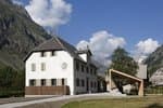
Valgaudemar Park house
Ancien Asile Saint-Paul, 05800 La Chapelle-en-Valgaudemar
Information, documentation and a reception area with permanent and temporary exhibitions. La Maison du Parc is labeled "Tourism and Disability". Free admission. All animations of the Park are free unless otherwise stated.
Access and parking
From the N85 road, take the departmental D 985 A road at Saint Firmin, and stop at the car park just before Villar Loubière.
Parking :
More information
Source

Report a problem or an error
If you have found an error on this page or if you have noticed any problems during your hike, please report them to us here: