Lake Quirlies
The impetuous Ferrand bridge waterfall sets the scene. There is running water everywhere, irrigating the pastures that thousands of sheep will graze on during the summer. The existence of carcasses means that it is an area well-known to vultures. Higher, the Suirelies glacier and the lake that is surrounded by granite moraines remind us of the high mountains, with a breathtaking viewpoint over the immense Emparis plateau, to the boundaries of l'Isère and La Savoie.
8 points of interest
 Architecture
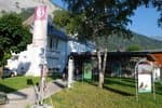
The house under the rock
Ingenious setting for a house backed up against the rock for protection in the case of an avalanche. The hamlet, that used to be inhabited all year round, now has mainly holiday homes. The surrounding fields are no longer mowed as they were previously and a herd of cattle more or less maintain the open landscape. Water
WaterThe Ferrand bridge waterfall
This is an impressive waterfall that reunites all of the Ferrand valley waters. Even when water levels are low, the water flow is still high as the glaciers on the east side of the Grandes Rousses provide a constant flow to the streams. Pastoralism
The Bruyère sheepfold
Pastoralism is omnipresent in the entire valley due to the variety of grasses that grow on loose soil made up mostly of shale. 20 000 sheep graze on this vast area during the summer. Fauna
FaunaBird's stone
A name that makes you think of the frequent position of the wheatear as it searches for grasshoppers The wheatear is a migratory sparrow that waits until the snow has melted before settling in the pastures. It builds its nest in a small hole in the ground or under turf and rears its chicks before September. Panorama
View from the spillway of the Quirlies lake
A halt at the lake's spillway enables you to take in the wide open landscape from the Aiguilles d'Arves to the Mont-de-Lans glacier or the Meije massif. At the lowest stage, the immense green cover waves its way across a more gentle relief due to the shale soil. Glacier
The Quirlies glacier
The Quirlies glacier went right down to the lake up until the 1990s. Due to climate disturbance it has retreated considerably leaving the entire lake visible today. You will notice the moraines that were left as the glacier retreated. Life is quickly renewed on such moraines, particularly with plants that are well-adapted such as moss campion and creeping avens.- Water
The Quirlies lake mineralogy
Jade and turquoise waters are characteristic of lakes that are said to be proglacial. It contains fine silica particles that make up a "glacial powder" suspended in the water, as a result of the overlooking glacier eroding the granite base. - Water
Lake Quirlies
This is one of the most recent lake of the Oisans area. It only appeared in the 1960s as a consequence of the melting glacier. It is true that topographical maps edited before then do not mention it. We can only imagine how far the glacier has retreated over the last 50 years.
Description
Follow the Sarenne pass road above Clavans-en-haut-Oisans to reach the hamlet of Perron. Park at the information board of the classified site of Le Ferrand. Before leaving with you rucksack, take a look at the house that is backed against the rock.
Set off on the signed footpath to get to the Ferrand footbridge and the majestic waterfall. Head up the wide track overlooking it, then cross another footbridge that leads progressively into a very green valley by staying on the right bank of the stream. The footpath then takes a pleasant route crossing many small streams coming from the higher valleys. Walk successively past the footpath that leads to Clos Chevaleret (a hike for another day), the Bruyères pastoral hut and close to a sheep pen and the bottom of the valley. On this large flat terrain, you will need to cross the stream to head further up to Pierre de l'Oiseau. Leaving the footpath to the Sauvage summit to the right, turn left to follow the one that leads up to the lake. This route is only ice-free as of mid-July. The return trip is made by the same itinerary up to Le Perron.
- Departure : Le Perron (Clavans-le-Haut)
- Towns crossed : Clavans-en-Haut-Oisans
Forecast
Altimetric profile
Information desks
Oisans Park house
Rue Gambetta, 38520 Le Bourg d'Oisans
Video presentation of the natural resources of the Oisans mountain and its crafts. Information, documentation about the Park, projections, reading space for children. Accessible to people with reduced mobility. Free admission. All animations of the Park are free unless otherwise stated.
Access and parking
At the Chambon dam (N91: Bourg-d'Oisans>Col du Lautaret) turn onto the D 25 go past Mizoën then Clavans-le-Bas and Clavant-le-Haut as far as Perron. From l'Alpe-d'Huez, in the summer, follow the Sarenne road beyond the aerodrome. Go over the pass and down into the Ferrand valley as far as Perron.
Parking :
Source

Report a problem or an error
If you have found an error on this page or if you have noticed any problems during your hike, please report them to us here: