La Muzelle pass
"A few years ago, before serious restoration work, this pass was known, rightly so, as a black spot of the GR54 route. In wet weather, without a pickaxe it was difficult to drag yourself to the top of the slippery slope, where you would reach the pass with blackened fingernails. Today it is still a demanding high mountain route and needs an early start and a good physical condition".
Daniel Fougeray, head of the Valbonnais area
8 points of interest
 Flora
FloraNatural Hayfields
Agricultural specialists consider a meadow as natural if it has not been ploughed or fertilised over the last ten years. This is the case for those that you will see, surrounded by hedges, at the start of the hike. The meadows have an important variety of plant life and consequently attract multitudes of pollinating insects, including domesticated bees of course. Pastoralism
Cantine cabin
The dry stone (mortar) huts are an example of architecture without an architect they are the work, not of architects (unlike the religious, military and civilian buildings of the past), but of farmers and workers or masons whose names are now forgotten. These huts have many and varied names, which are mainly derived from regional languages, and which have been adapted into French. The Cantine (“Canteen” in English) huts were used as shelters for shepherds during the summer months, and probably owe their name to the meals eaten in the mountains.
 Geology and geography
Cipollino Marble quarry
From the 19th century, a cipollino marble quarry operated here. This marble had a white-green base colour with wavy green veins and a thick layer of mica. Les Cantines (canteen) hut is so-called because it was where the workers would have their meals. It was recently renovated and is used by the shepherd at the beginning and the end of the season.- Pastoralism
Pastoral management
From July to September, a flock of sheep occupy this steep valley. A shepherd watches over them and tends to them if necessary. Pastures are divided into sectors that are grazed upon according to a timeframe that takes the exposition and grass resources into consideration. For example, specific agro-environmental measures are in place to preserve the areas where black grouse nest. When the chicks are able to fly, usually after the 15th August, the sheep can head back to the area.
- Geology and geography
Glacier polished rocks
Around 15 000 years ago, the last glaciation ended. As it receded, the glacier left traces of its passage. Indeed, the withdrawal of such huge masses of ice polished the rocks and gave them a rounded shape, which is very apparent from the left bank of the valley. These rocks are known as 'moutonnées".  Vernacular heritage
Maintenance of the footpath
After many complaints from hikers, the decision was made in 2010 to employ the necessary means to improve security on the route. It took a mechanical 'spider' digger a day and a half to climb all the way up to the pass. It then dug out the footpath as it went down the black shale on a 40° degree slope. Each year, serious manual work is undertaken to ensure that hikers have safe access. Fauna
FaunaWallcreeper
As you get to the last leg before the pass, you may well hear high-pitched whistles. If you are lucky, you will catch sight of the composer of this melody: the wallcreeper, which is a beautiful red, black and white bird. Defying verticality, the wallcreeper uses its long-clawed feet to latch onto the rock faces in search of insects and spiders. Its long beak then enables it to draw them out of the cracks in the rock.
- Flora
Altitude flora
Near to the pass, you will admire small grey-green cushions scattered with white flowers: this is the androsace helvetica, a rare protected species. This altitude plant is perfectly acclimatised to the hostile environment. This is also the case for the mountain saixifrage. Both like limestone, which is not the case of moss campion, small green cushion with pink flowers, or the Arctic alpine forget me not, a small blue-flowered plant that prefer the crystalline rocks here and there across the pass.
Description
From the Valsenestre car park, walk up the forestry track that heads east. Two footbridges enable you to cross the stream in the forest, made up essentially of conifers (pine, spruce, larch) that encloses a few odd meadows that are still mowed. Higher up, at an altitude of 1492 m, turn left to reach the edge of the forest that will give a view of a vast rock fall zone that is partially vegetated. Once you have arrived at Les Cantines mountain hut, the footpath climbs significantly on the steep slope that is grazed by sheep in the summer. On the opposite slope, you will be able to see the old footpath that climbs in tight bends to reach the hut that is cut out of the marble. You can see the entrance. Half-way, you will see the pastoral hut of Ralu on the left. The last stretch, towards 2350 m, is very steep and you will walk around many bends to cross the shale. From afar, it looks like and insurmountable wall, but in fact the footpath, which is well-maintained, makes it possible to reach the pass at 2613 m in altitude Follow the same route in the opposite direction for the return trip.
- Departure : Valsenestre
- Towns crossed : Valjouffrey
Forecast
Altimetric profile
Sensitive areas
Golden eagle
- Impacted practices:
- Aerial, , Vertical
- Sensitivity periods:
- JanFebMarAprMayJunJulAug
- Contact:
- Parc National des Écrins
Julien Charron
julien.charron@ecrins-parcnational.fr
Recommandations
Caution: névé possible on the last parts in the spring that mean you may need crampons and ice axes.
 In mountain pastures, protection dogs are there to protect the herds from predators (wolves, etc.).
When I hike I adapt my behavior by going around the herd and pausing for the dog to identify me.
Find out more about the actions to adopt with the article "Protection dogs: a context and actions to adopt".
Tell us about your meeting by answering this survey.

Information desks
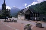
Maison du Parc du Valbonnais
Place du Docteur Eyraud, 38740 Entraigues
Reception, information, temporary exhibition room, reading room and video-projection on demand. Shop: products and works of the Park. Free admission. All animations of the Park are free unless otherwise stated.
Access and parking
D26 from La Mure D526 from Pont du Prêtre D117 from Entraigues to La Chapelle and Valsenestre.
Parking :
Source

Report a problem or an error
If you have found an error on this page or if you have noticed any problems during your hike, please report them to us here: