Pétarel Lakes by the Andrieux
The silent forest cover of Silver Firs, populated by enormous ants, gives a mysterious character to this ascent. Then, the landscape of the lake offers hikers wonder and serenity.
11 points of interest
 Flora
FloraYellow Figwort
There are plants that are like no others. That is the case of the Yellow Figwort. Its tall size (30 à 80 cm), its hairyness, its square stalk with large indented leaves and its yellow-green colour form a combination that catches the eye. A very rare plant in the Hautes-Alpes, its distribution area covers all of central and Southern Europe, the Pyrenees and Russia. It flowers between April and July. It probably escaped from Medieval medicinal gardens cultivated by monks. Its habitat is particular: in ruins and old walls. Please do not pick it since it is interesting simply to observe it.
 Fauna
FaunaBoreal Owl
The Boreal Owl is a typical species from the conifer forests. It is present throughout the year in the mountainous areas of France. In this forest, there live several individuals who are hard to spot.. Easily recognizable, the Boreal Owl has golden-yellow coloured eyes, circled with black topped with clear coloured eyebrows. It most often nests in holes bored by the Black Woodpecker or in natural cavities in old trees.It feeds on small mammals : field mice or voles that it hunts at night.
- Fauna
Red Ants
Numerous anthills are present in the forest area. Anthills are composed of accumulated vegetable detritus.. The principal rôle of the dome is the thermoregulation of the anthill, in particular for the brood. In fact, the temperature of the ants’ eggs must not go above 25°-30°C. The weight of this habitat can be amazing: up to 20 kilos for a nest of 3 m cubed.. Apparently anthills are a sign of a healthy environment. So please respect these little creatures!
 Panorama
Cime du Vallon
The Cime du Vallon is an easy stretch of snow to hike or ski across in Winter and in Spring. Starting from Chapelle-en-Valgaudemar, it offers a difference in levels of 2 350 m.
- Panorama
Pic des Souffles
The first summit in the valley at an altitude of more than 3 000 m, It is hardly visited by mountaineers. At the beginning of the story of mountaineering, the pic was highly frequented by local guides who opened the first trails. Currently rated AD (quite difficult) it has been equipped. The approach is long but worth it for the suspended atmosphere. The passage to the refuge of the same name will leave nobody unmoved.
- Panorama
Pic de l'Olan
The Pic de l'Olan is a summit like a beacon in the valley. Its North East face is one of highest and wildest in the Alps. like the Walker rocky spur or the Drus (in the Mont-Blanc massif). Its name is a deformation of ‘Auran’ which signifies « windy mount ». The first ascent of Northern summit was carried out on 29th June 1877. For mountaineers, it represents a good climb accessible to all levels accompanied nevertheless by a high-mountain guide.
- Panorama
Pic Turbat
A pretty 3 000 m achievable as an athletic hike in summer, it can be seen from the Souffles de l' Olan refuge.It is also a lovely belvedere over the first part of the valley and across the large North-West face of the Olan. On the way back, a pause beside the little Lautier lake is not to be missed.
 Geology and geography
Granite at Pic Turbat
This very compact granite (on the facing slope), consists of fine grains, and the clear colour which is specific to Pic Turbat. It is formed from drops of granite that came back up across le magma, and which were then uncovered due to erosion.
- Geology and geography
Combination of minerals in the Olan and the Turbat
The mineral combination (situated in the facing slope) consisting of the Olan and the Turbat offers an interesting reading of the diverse geological layers. This site is characteristic of alpine territory. These last high mountainss at the heart of the massif exceed the crystalline base by 3 500 m.
 Lake
LakePétarel Lakes
The Pétarel lakes are relics of a long glacial and geological history. They are the result of glacial abrasions in the Hercynien granite, base rock of the Ecrins massif.
- Lake
Scientific monitoring of the Pétarel Lakes
A scientific protocol was put in place on the lake at Pétarel in order to follow the evolution of fish, zooplankton and phytoplankton.This lake constitutes a singularity in the mountain parks, it is a witness to climatic and historical evolution. This protocole is carried out with other services: The Mediterranean Institute for Continental and Marine Biology (IMBE), The National Office for Water and Aquatic Environments (ONEMA) and the Departmental Federation of Fisheries in the Hautes-Alpes.
Description
From Andrieux car park at the level of the fountain place cross the main road in front of the small chapel and go towards the end of the village in the direction of the pine forest.. At the level of the entrance to the National Park indicated by signposts, climb the track going up to the left. At an altitude of 1 400 m, leave the track going towards la Chapelle-en-Valgaudemar and des Portes hamlet (a bit higher up) on the left, staying on the same path. The ascent continues for some time in the forest which brightens up progressively.. Walk carefully through the last rocky passages. A large cairn signals your arrival at the lakes. Return using the same itinerary.
- Departure : Hameau Les Andrieux, la Chapelle-en-Valgaudemar
- Towns crossed : La Chapelle-en-Valgaudemar
Forecast
Altimetric profile
Sensitive areas
Short-toed snake eagle
- Impacted practices:
- Aerial,
- Sensitivity periods:
- MarAprMayJunJulAugSep
- Contact:
- Parc National des Écrins
Julien Charron
julien.charron@ecrins-parcnational.fr
Recommandations
Under the glacial cross cliff, certain crossings can be slippery especially in wet weather. NB : the bivouac is only allowed (from 19h à 9h) and rubbish must be taken away in order to preserve the site.

Information desks
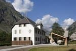
Valgaudemar Park house
Ancien Asile Saint-Paul, 05800 La Chapelle-en-Valgaudemar
Information, documentation and a reception area with permanent and temporary exhibitions. La Maison du Parc is labeled "Tourism and Disability". Free admission. All animations of the Park are free unless otherwise stated.
Access and parking
From Saint-Firmin, take the D985A/route de La Chapelle-en-Valgaudemar, continue on this road to the Andrieux hamlet.
More information
Source

Report a problem or an error
If you have found an error on this page or if you have noticed any problems during your hike, please report them to us here: