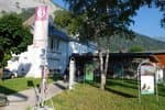
Châtelleret Refuge
This ascent gives the opportunity firstly to discover the magnificent moraine of the Bonnepierre valley and the West face of the Ecrins. Then, a crossing through the junipers and the rhododendrons, where the landscape opens out on to the South face of the Meije and the Rateau summit.
11 points of interest
 History
Bérarde Hamlet
La Bérarde, is a hamlet representing the history of mountaineering and its corollary touristic development in the vallies. A heterogenous collection of welcoming buildings and businesses. So many modest but representative examples of the successive periods in time of tourist facilities on this emblematic site in the history of this valley.
 Geology and geography
The South face of the Meije
Up from the Chatelleret refuge, numerous rocky boulders seem to have come from the lateral walls of the Étançons. In reality they come from the bottom of the valley. In the 1960s, three successive landslides marked the whole Étançons valley. One carried a part of the Zsigmondy breach and the two others originated in the Western Meije. During its surrection, the crystalline Écrins massif underwent big fractures which are still visible on the high summits around the Bérarde. The network of diaclese (cracks) not being very dense in the Meije, detachments of boulders from the wall resulted in landslides which covered the valley in large boulders. You can see on the South face of the Meije, a granite substructure surmounted by a crowning of darker gneiss. The contact between the two natures of rock is underlined by a ledge that you can follow really well in the landscape at the base of the Carré au Pavé glacier passing by the Western part of the Meije.
- History
 Flora
FloraCoincya richeri
The Coincya richeri is an endemic plant that is uniquely found in the small region situated in the triangle of Mercantour-Ecrins-Vanoise. It colonizes granite scree. Its leaves are bluish and from them a shaft of pale yellow flowers escapes... Although it is not chubby like a garden cabbage, the same bloom (a sort of waxy dust) is found on the leaves. Its name in comes from the founder of the botanical garden in Montpellier Richer de Belleval after who was very famous in the 16th century.
- Flora
Alpine Willow Herb
The Alpine Willow Herb stands near to the glaciers, in the scree and the rocky bed of the torrents. After burial, in the scree, it develops long and abundant runners (long stalks without leaves) that enable it to reappear. The Alpine Willow Herb flowers between July and September.
- Flora
White Flowered Adenostyle
This Adenostyle grows at an altitude of between 1 900 and 3 100 m, where it colonizes the crystalline scree right up to the edge of the snow pockets and the glaciers. It sometimes slips between the boulders in order to benefit from the humidity created by the differences in temperature between the day and the night, which is great in this area. The leaf beetle particularly appreciates this location and it’s covering of Adnostyles. This small insect, with a shiny blue and sometimes green carapace, abounds on the leaves that if feeds on without putting the plant in peril.
 Hut
HutPromontory Refuge
The promontory refuge is situated at the bottom of the Etançons valley and can be seen from the Châtelleret. In 1901, a wood cabin (situated higher up) was built at the end of the way on the ridge of the Promontory at 3092 m at the Southern face of the Meije. This shelter of a frail appearance offered refuge to mountaineers in search of the prestigious summit: The Meije, the Barre and the summit of the Dôme des Ecrins. If the roof did not give in to the gusts of wind, the door was often stuck in the snow. However the cabin resisted all kinds of bad weather. More than 60 years passed before the construction of a new larger and more comfortable refuge in 1966. On this occasion a lift was used in order to transport materials left at the base camp by a helicopter.
- Hut
Châtelleret Refuge
In 1882, a very simple one roomed construction was built by the CAF at the place where Gaspard and his companions bivouacked. This pioneering refuge ensured survival and protection from bad weather for the mountaineers. Made with thick stone walls, covered with wood inside, it soon became too cramped and the base of the existing refuge was built in 1957. Following its extension in the 1980s, it can now sleep 68 people and welcomes hikers for a break in the day. Today, the name of the family Paquet from Saint-Christophe has been associated with the story of the refuge for the last 40 years...
- History
Favourite Mountaineering locations
The Etançons valley is the starting point for many mountaineering races: the breach and the crossing of the ridges of the Meije, Ecrins mountain pass, Northern peak of the Cavales, the Rateau, etc. Boileau de Castelnau accompanied by Pierre Gaspard carried out the first ascent of the Meije in August 1877, ending seven years of bitter competition. The former, greatly admired by the English, would become the symbol of the beginning of tourism in the Oisans. In fact, at that time, the massif was still unknown, the road only came up to Bérarde. Only a few chamois hunters and rare mountaineers had explored this wild and deep valley.
- History
Mountaineering in the Bérarde
The Ecrins massif only began to interest mountaineers in the second half of the 19th century. . Except for the ascent of the Pelvoux in 1830 by Capitain Durand, it was the British who victoriously signed their names on many of the summits. Coolidge remains without a doubt the greatest discover of the virgin peaks between 1870 and 1886, with no less than 53 ascents to his name! The highest summit, la Barre des Ecrins (at an altitude of 4102 m), as conquered in 1864 by Moore and Whymper. There just remained the Meije that certain believed to be inaccessible...
- History
Beginnings of mountaineering
The beginnings of mountaineering are linked with those of tourism in the mountains. In the first place, it was the site of Chamonix that provoked the interest of two English "tourists" William Windam and Richard Pococke. In the European salons, the mountain became progressively more fashionable... The local populations adapted to the demand: the inhabitants, experts concerning their mountain supplemented their pastoral activies by becoming mountain guides. . In 1786, two Chamoniards Doctor Paccard and Jacques Balmart reached the summit of Mont Blanc. The following year the conquest of the summits, benefited from a scientific project (the physical observation, re topographic survey of the massif). Moutaineering was born at last. In 1874, the first French mountaineering club was founded by Adolphe Joanne (geographer), Georges Hachette (editor) and Eugène Viollet-le-Duc (architect).
Description
Reach the ‘Maison de la Montagne’ at the end of the village and take the track that winds upwards to the pine forest. When you arrive at the lower shelf (entrance to the heart of the Park) follow the valley by crossing the walkway over the Bonnepierre torrent and join the Plat des Etançons, to observe the West face of the Barre des Ecrins. The track follows on flat ground in the valley. Having passed the confluence of the Plaret Gény valley, behind you to the left, the refuge appears in the distance, discreet among the stone boulders, la Meije at an altitude of 3983 m and the Râteau can be seen at the bottom of the valley. Stay on the marked trail to reach the Châtelleret refuge at an altitude of 2232 m. Return using the same itinerary.
- Departure : La Bérarde, Saint-Christophe-en-Oisans
- Towns crossed : Saint-Christophe-en-Oisans
Forecast
Altimetric profile
Sensitive areas
Golden eagle
- Impacted practices:
- Aerial, , Vertical
- Sensitivity periods:
- JanFebMarAprMayJunJulAug
- Contact:
- Parc National des Écrins
Julien Charron
julien.charron@ecrins-parcnational.fr
Recommandations
On busy days, it is possible to park at the entrance of the village just before the bridge.

Information desks
Oisans Park house
Rue Gambetta, 38520 Le Bourg d'Oisans
Video presentation of the natural resources of the Oisans mountain and its crafts. Information, documentation about the Park, projections, reading space for children. Accessible to people with reduced mobility. Free admission. All animations of the Park are free unless otherwise stated.
Transport
Coach stop : La Bérarde
Access and parking
From Bourg-d'Oisans, take the D1091 then the D530 in the direction of Bérarde (34 km). Narrow road from Champhorent hamlet, closed in winter.
Parking :
More information
Source

Report a problem or an error
If you have found an error on this page or if you have noticed any problems during your hike, please report them to us here: