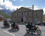
Laurichard Mountain Pass
On the track, at an altitude of about 2500 m, look about! In the South/South East direction you can see at the foot of the Western peak of the Combeynot four white spheres (about 35 cm in diameter)... they are the landmarks enabling scientists to measure the evolution of the rock glacier at Laurichard.
5 points of interest
 History
Dismantled ski-lifts
A small ski resort was created in 1970 not far from the Lautaret mountain pass. Due to the risk of avalanches and new standards required, alpine skiing was moved near to the village of Villar d'Arène and Chazelet hamlet. The two obsolete ski-lifts situated in this very picturesque territory, rich in terms of biodiversity, ruin this place which has been classified since1974 as the national nature reserve of Combeynot. In 2013, dismantling was carried out by the Mixed union of ski-resorts in the Haute Romanche with the support of the National Park. In the end more than 35 tons of iron and concrete blocks were evacuated.
 Flora
FloraFringed sedge
Protected patrimonial species which flowers between July and August, the fringed sedge is present in the sector of the Combe de Laurichard. It is the subject of a detailed prospection by the National Park. Result: on the crystalline sites of the Laurichard valley, it is not as rare as all that…
 Geology and geography
Rock glacier
The Laurichard rock glacier has been monitored since 1979. It is the oldest research program of this type studying the morphology of glaciers. At the moment the Ecrins National Park and the scientists are studying the evolution, the speed of its advance and its volume. On the terrain, note the presence of four white spheres which are used to carry out this monitoring.
 Fauna
FaunaRock Ptarmigan
The cold bottom of the Laurichard valley is where the Rock Ptarmigan lives (species that is a glacial relic). Its Latin name ‘Lagopus’ signifies "hare’s foot": this species reproduces during the warm season in the valley. It is one of the ten species of bird to be protected in priority in the heart of the National Park. Take care to stay on the path to avoid disturbing their nests...
 Panorama
Laurichard Mountain Pass
The Laurichard mountain pass, at an altitude of 2654 m, offers a superb panorama over the Meije massif and the surrounding summits : le pic Gaspard, la pointe Nérot, le Bec de l'Homme,... In the South the Barre des Ecrins points its icy nose behind the Roche Faurio.
Description
Leave the car park at the foot of Serre Orel to start the ascent in the direction of the Combe de Laurichard. Do not hesitate to look at the signs in the car park, marked « porte du parc national des Ecrins ». 250 m after the car park, the track divides into tow: stay on the one that goes up towards Laurichard and leave to your right the « track for the interpretation of crevasses ». The slope accentuates progressively up to the entrance of the Combe de Laurichard (alt. 2300 m), mineral world ‘par excellence’. The path follows its route at the foot of the South-East face of the pyramid of Laurichard and looks up at the imposing Northern faces, somber and austere, the summits at Combeynot (black rock of Combeynot and the West peak of Combeynot). It is at the foot of these two mineral giants that the Laurichard rock glacier is found with its permafrost – the soil is permanently frozen – but for how much longer, due to global warming? - Continue the ascent to reach Laurichard mountain pass, the panorama embraces the entire Meije massif and the surrounding summits (pic Gaspard, pointe Nérot, Bec de l’Homme,). For the descent, use the same itinerary in the opposite direction.
- Departure : Col du Lautaret
- Towns crossed : Villar-d'Arêne
Forecast
Altimetric profile
Recommandations
Put a top in your bag; the weather changes so quickly at these altitudes.
 In mountain pastures, protection dogs are there to protect the herds from predators (wolves, etc.).
When I hike I adapt my behavior by going around the herd and pausing for the dog to identify me.
Find out more about the actions to adopt with the article "Protection dogs: a context and actions to adopt".
Tell us about your meeting by answering this survey.

Information desks
Information center "Col du Lautaret" (summer only)
Col du Lautaret, 05220 Le Monêtier-les-bains
Under the gaze of the Meije (3983 m) and surrounded by beautiful meadows celebrated in the great names of botany, the former hospice of the Lautaret called "refuge Napoleon" houses the reception and information Park center - Projections, documentation, books of the Park. Accessible to people with reduced mobility. Free admission.
Transport
The bus Grenoble - Briançon, via the Lautaret mountain pass (regional express line: LER 35).
Access and parking
D1091 (Grenoble Briançon), col du Lautaret.
Parking :
Source

Report a problem or an error
If you have found an error on this page or if you have noticed any problems during your hike, please report them to us here: